Our success in creating business solutions is due in part specially to talented committed team.
Harnessing the potential of the untapped geographic information market to facilitate informed decision-making through spatial data collection, mapping, and analysis.
Professional Geographic Information System (GIS) services are provided by BIMQP, which converts spatial data into useful insights. They assist clients in visualizing and analyzing geospatial data associated with particular locations by using GIS software and contemporary geospatial technology. Through precise GIS mapping services and spatial data management, their GIS solutions assist with environmental analysis, infrastructure projects, and urban planning. BIMQP facilitates more intelligent, data driven decision making by emphasizing location intelligence. Services also include GIS consulting and field support, aligned with standards like those from the National Remote Sensing Agency. For organizations exploring what is GIS or seeking real-world GIS applications, BIMQP delivers trusted, efficient results.
BIMQP offers expert GIS consulting, helping organizations leverage geospatial data and mapping tools for smarter decisions, improved planning, and tailored solutions across industries.
Application design and development as well. We will help you in delivering high-quality, business application solutions that are scalable, robust, revolutionary, and easy to understand and maintain.
At YCSPL, we simplify geographic data collection and processing, transforming physical maps and inputs from GPS, LiDAR, and remote sensors into valuable GIS insights for your business.
The success of your business project will be determined by a lot of factors including the accuracy of data that are being used by it. GIS-based survey is important and brings all the assets in a single platform.
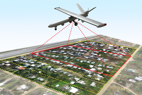
BIMQP offers aerial imaging and mapping services using drones with high-resolution and thermal cameras, streamlining inspections and surveys for urban and rural projects.
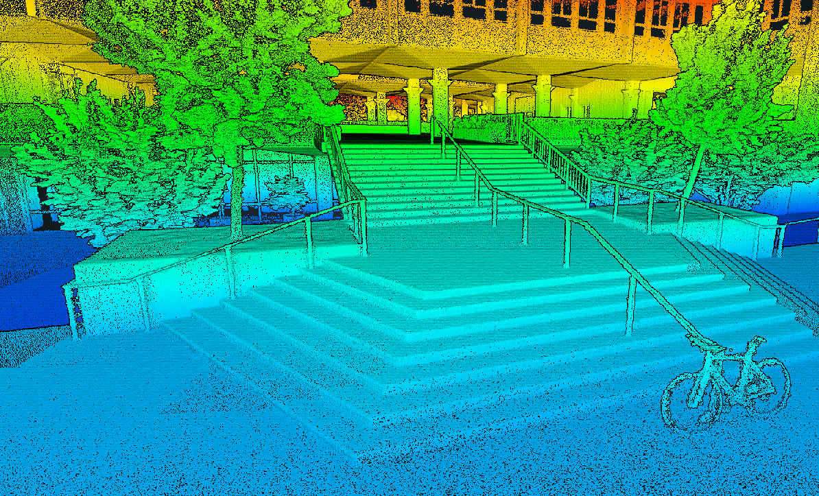
Our exemplary GIS services provide timely information to managers and analysts. We convert data from paper maps to computer files that automates the process using appropriate scanning technologies.

Data acquisition, point cloud classification, DTM, DEM and DSM generation, contour generation, ortho generation,

Asset & plant inspections, engineering & construction, mining & resources, thermographic imaging, surveying services
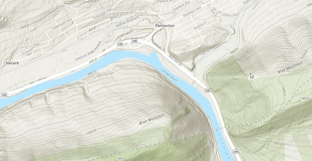
Disaster management, engineering and architectural purposes, route planning, telecom and transport services
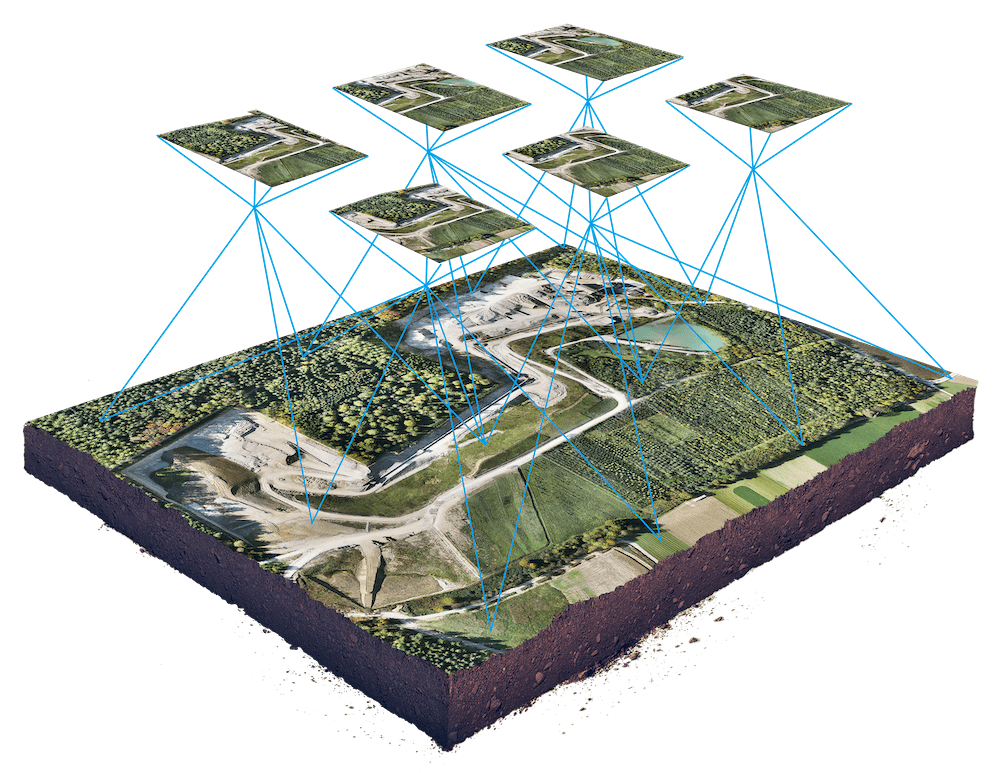
A wide variety of photogrammetric services such as aerial photogrammetry and digital photogrammetric services
Our success in creating business solutions is due in large part
spacially to talented and highly committed team.
Full Time
Full Time
Part Time
Full Time
Discover expertise and visionary solutions with us. Partner with industry pioneers to elevate your projects through groundbreaking innovation.
With over two decades of leadership experience, we excel in spearheading and implementing BIM solutions. Our extensive portfolio encompasses diverse, high-value projects totaling billions, showcasing our unparalleled expertise and commitment to excellence.
We provide comprehensive solutions, eliminating the need for fragmented services. Our one-stop approach not only streamlines costs but also ensures clients have everything they need, making BIMQP the definitive destination for unparalleled BIM services.
With a foundation rooted in government and corporate experience, we excel in large-scale deployment on a national level. Our extensive knowledge and widespread adoption set us apart for impactful solutions.
We leverage a diverse range of software and technologies tailored to your project’s unique requirements, following a project-centric approach for optimal outcomes.
Our success in creating business solutions is due in large part spacially to talented and highly committed team.
